HOME | DD
 ainsleyblyat — Occupation of France during WW2 (Equirectangular)

#frenchhistory #maps #ww2 #historicalmaps #france #historical #history #worldwar2 #historicallyaccurate #ww2worldwar2 #mapsandflags #maps_and_flags #historymaps
Published: 2021-07-26 15:29:35 +0000 UTC; Views: 12880; Favourites: 113; Downloads: 54
Redirect to original
Description
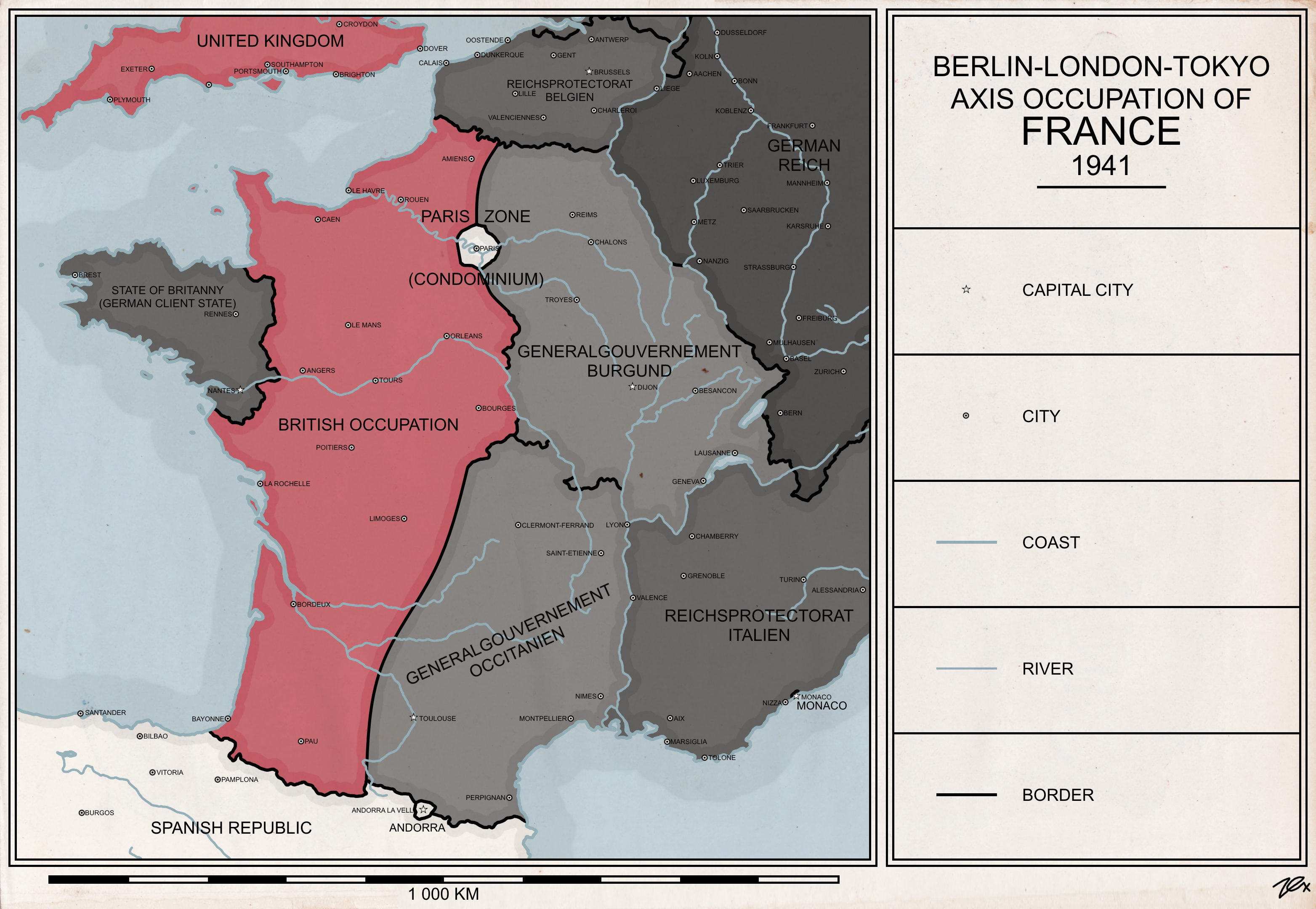
The Third French Republic fell with the Armistice of June 22 1940, as the government under Philippe Petain and Pierre Laval surrendered after the French army was annihilated during Operation Fall Rot. Most politicians fled from the country to continue the fight for the allies, most notably general Charles de Gaulle who later established Free France in Africa.Throughout the war, most of France fell under the direct occupation of the Wehrmacht to ward off any possible naval invasion by the allies. The rest of the country fell under the direct government of what remains the now collaborationist French government, with political oversight from Germany. Vichy France would only fall on August 19 1944 following the formation of the Sigmaringen Commission and the subsequent ensuing allied liberation of France.
This map was made due to the lack of reliable and good quality sources for the territories and borders, and to also show off the current progress on Examap, my map template project which you can find on my discord server: discord.gg/njS9KWathk
The map is in the Equirectangular projection, the font is MS Reference Sans Serif.
Related content


Comments: 3

👍: 1 ⏩: 1

👍: 0 ⏩: 1
👍: 2 ⏩: 0